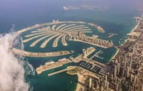
In 2023, the government of Dubai formally restructured and rebranded the previously known Deira Islands into a new five-island master plan under the name Dubai Islands. The move was not just about renaming; it marked a shift in long-term urban development policy aligned with the Dubai 2040 Urban Master Plan. Designed as a next-generation coastal district, Dubai Island reflects a broader strategic framework focusing on decentralization, sustainability, and economic diversification.
The development comprises five interconnected islands—Central, Shore, Oasis, Golf, and Elite—each assigned a specific urban function. Residential neighborhoods, hospitality zones, wellness districts, and cultural hubs are distributed across 17 square kilometers of reclaimed land, forming an urban archipelago intended to accommodate over 38,000 housing units and more than 80 hotels and resorts.
New Zoning Logic: Mixed-Use Without High Density
Residential projects on the Central Island are early indicators of how urban design priorities are shifting. Rather than high-rise clusters, developers are building mid-rise, pedestrian-oriented buildings with integrated public spaces. Projects like Ellington Cove, Isolana Residences, and Cotier House follow a similar pattern: moderate scale, proximity to water, and access to car-free promenades.
This approach reflects a move toward “distributed density” — a model that balances housing supply with environmental standards and social cohesion. Instead of building vertically in centralized zones, Dubai Islands disperses development horizontally across themed islands, each with controlled land-use plans, regulated height limits, and integrated infrastructure.
Alignment With Dubai 2040 and Gulf-Wide Trends
Dubai Islands is one of the highest-profile projects implementing the goals of the Dubai 2040 Urban Master Plan, a framework that envisions a polycentric city structure supported by sustainable transport, green spaces, and compact neighborhoods. The plan aims to increase the length of public beaches by 400%, double the land allocated to leisure and parks, and ensure that 55% of the population lives within 800 meters of a public transport station.
Dubai Islands supports these targets through:
- 21 km of public and private beaches
- 2+ million sq. m of open green space
- 9 marinas and two golf courses
- A multi-modal transport grid, including water transit and cycling infrastructure
In regional context, the project reflects broader GCC trends in state-driven master planning: long-horizon timelines, vertical integration of real estate and infrastructure, and thematic zoning as a governance tool.
Diversification Through Real Estate and Tourism
Real estate and tourism remain central to the UAE’s economic diversification strategy. Dubai Islands is structured to support these sectors by combining freehold ownership rights with residential visa eligibility and high-yield tourism assets.
Key investment features include:
- Foreign ownership for all nationalities (freehold)
- 2- and 10-year residency visas for property buyers
- Short-term rental licensing across hospitality zones
- Tiered pricing strategy for multiple buyer segments
Tourism is built into the land-use framework, with zones allocated for wellness resorts, boutique hotels, marina districts, and cultural venues. This helps mitigate seasonal demand cycles and supports Dubai’s broader positioning as a year-round lifestyle destination.
Infrastructure-Led Growth Model
The phased development of Dubai Islands is driven by public-private coordination. Nakheel, the master developer, is leading infrastructure rollout in parallel with private-sector real estate launches. The project’s integration with the Infinity Bridge ensures connectivity to Deira, Dubai Creek, and Downtown, reducing the historical divide between “Old Dubai” and new development zones.
Mobility within the island cluster is designed around walkability and water transport. Future plans include:
- Car-free waterfront promenades
- Electric shuttle systems between districts
- Direct ferry routes to the Dubai mainland
- Marina infrastructure supporting tourism and logistics
This infrastructure-first strategy reflects a shift from reactive to proactive urban expansion — anticipating population and demand, rather than responding to it after the fact.
Governance, Land Control, and Spatial Strategy
Dubai Islands offers insight into how the UAE uses master-planned developments as instruments of spatial governance. Each island has clearly defined land-use boundaries, commercial quotas, residential density caps, and controlled building height regulations. These constraints are enforced at the planning stage, allowing for greater long-term control over demographic mix, traffic loads, and environmental impact.
This model allows authorities to coordinate real estate supply with public service capacity, reducing strain on utilities, roads, and waste systems. It also enables better segmentation of target audiences: Elite Island caters to ultra-high-net-worth individuals, while Oasis and Central Islands serve mid- to high-income residents and tourists.
Dubai Islands is more than a real estate development; it is a policy instrument shaped by long-term urban and economic goals. Its structure reflects a move toward decentralized, infrastructure-led urbanism supported by strict planning controls and a clear investment narrative. For observers of urban development in the Gulf, it serves as a case study in how state-led planning can define not just physical landscapes but also demographic, economic, and governance outcomes.

Leave a Reply