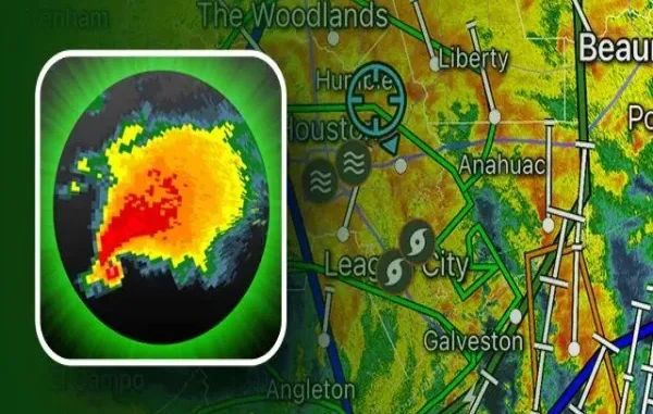
Staying ahead of changing weather conditions is crucial for boaters’ safety and navigation. Sudden storms, high winds, and rough seas can pose serious risks, making real-time weather tracking essential. With advanced technology, a marine navigation app provides boaters with reliable storm tracking and weather alerts, helping them make informed decisions while on the water. Whether planning a short trip or a long offshore voyage, this app can enhance your situational awareness and keep you safe from unexpected weather hazards.
1. Real-Time Weather Updates for Safer Navigation
One of the most essential features of a marine navigation app is its ability to provide real-time weather updates. Instead of relying on outdated forecasts, boaters can access up-to-the-minute data, including:
- Wind Speed and Direction – Helps determine safe routes and anchorage locations.
- Wave Height and Swell Patterns – Critical for avoiding rough seas and ensuring a smooth ride.
- Temperature and Humidity Levels – Useful for planning comfortable and safe trips.
With live weather updates, boaters can anticipate changes and adjust their routes accordingly, minimizing risks while at sea.
2. Advanced Storm Tracking Capabilities
Marine navigation apps use radar technology and satellite data to monitor storms and severe weather conditions in real-time. This allows users to:
- Track the Path of an Incoming Storm – See the storm’s projected movement and estimated arrival time.
- Analyze Storm Intensity – Understand wind speeds, rainfall levels, and potential dangers.
- Receive Early Warnings – Get notifications about developing weather systems before they become hazardous.
By leveraging these storm-tracking features, boaters can take proactive measures, such as rerouting or returning to shore before conditions worsen.
3. Automated Weather Alerts for Quick Decision-Making
Unexpected weather changes can happen quickly, especially in open waters. A marine navigation app ensures that users receive automated alerts based on the following:
- Severe Thunderstorm Warnings – Notifies boaters about heavy rain, strong winds, and lightning.
- High Wind Advisories – Helps prevent sailing in unsafe wind conditions.
- Tropical Storm and Hurricane Alerts – Provide updates on storm development and recommended safety measures.
These alerts allow boaters to act immediately, avoiding dangerous weather patterns before they become life-threatening.
4. Integrated Radar and Satellite Imaging
High-quality marine radar and satellite imaging are key components of an effective marine navigation app. These features help boaters visualize weather patterns and make better-informed choices by providing:
- Real-Time Doppler Radar Maps – Displays precipitation, storm cells, and wind speeds.
- Infrared Satellite Images – Helps detect cloud cover, temperature changes, and storm formations.
- Lightning Detection Systems – Warns about potential lightning strikes in the area.
With these advanced imaging tools, boaters can assess conditions more accurately, reducing the risk of being caught in severe weather.
5. Route Planning and Alternative Safe Paths
A marine navigation app not only tracks storms but also assists in planning safe and efficient routes. Boaters can:
- Avoid Storm Zones – Identify safer paths to prevent encountering dangerous weather.
- Mark Emergency Anchor Points – Locate nearby harbours or protected bays for shelter.
- Access Tidal and Current Data – Optimize travel plans based on changing sea conditions.
A reliable route planning system ensures boaters remain prepared, even when unexpected weather challenges arise.
6. Seamless Connectivity with Other Marine Devices
Many modern marine navigation apps integrate onboard GPS, AIS (Automatic Identification System), and VHF radios, allowing for a more connected experience. This helps in:
- Sharing Weather Data with Other Boaters – Creating a community-based weather tracking system.
- Syncing with Marine Instruments – Ensuring accurate positioning and weather monitoring.
- Receiving Coast Guard Alerts – Staying updated on emergency broadcasts and safety guidelines.
This seamless connectivity enhances situational awareness and promotes safer maritime travel.
Final Thoughts
A marine navigation app is an essential tool for boaters. It provides real-time weather updates, storm tracking, and automated alerts to enhance safety at sea. By integrating advanced radar imaging, route planning, and connectivity features, these apps help boaters stay ahead of changing conditions, ensuring a safer and more enjoyable experience on the water. Whether navigating coastal waters or heading offshore, having access to accurate weather data can make all the difference in avoiding storms and ensuring smooth sailing.

Leave a Reply